2009
TG4014 : Entrance to Upton Black Mill
taken 15 years ago, near to Thurne, Norfolk, England
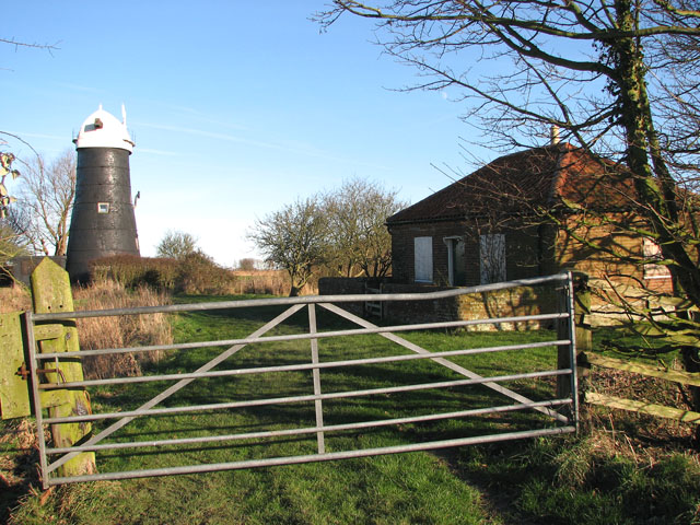
Entrance to Upton Black Mill
Upton drainage mill is also known as Upton Tall mill or Upton Black mill - so called because its red-brick tower is tarred black. The mill has a boat-shaped cap which once had a gallery with a petticoat and a fan stage. A date stone set under a window facing the river indicates that the mill was built in 1800. The mill is adjoined by a former millkeeper's house (seen at right) which was used for holiday accommodation in the 1970s, and by 1985 the mill was recorded to have been converted into private accommodation. A modern drainage pump is located nearby.
 Map © Crown Copyright")
TIP: Click the map for more Large scale mapping
- Grid Square
- TG4014, 84 images (more nearby 🔍)
- Photographer
- Evelyn Simak (more nearby)
- Date Taken
- Tuesday, 6 January, 2009 (more nearby)
- Submitted
- Tuesday, 6 January, 2009
- Subject Location
-
OSGB36:
 TG 404 141 [100m precision]
WGS84: 52:40.2729N 1:33.3185E - Camera Location
-
OSGB36: TG 404 140
- View Direction
- Northeast (about 45 degrees)