2009
TG4014 : Public footpath past Upton Black Mill
taken 15 years ago, near to Thurne, Norfolk, England
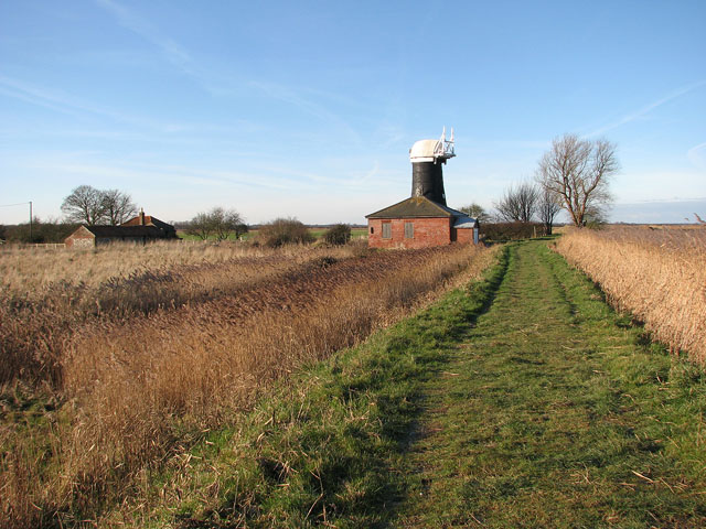
Public footpath past Upton Black Mill
This public footpath leads along the elevated bank of the River Bure, here passing Upton Black Mill > Link. It can be followed in northerly and then in westerly direction all the way to South Walsham Broad.
 Map © Crown Copyright")
TIP: Click the map for more Large scale mapping
- Grid Square
- TG4014, 84 images (more nearby 🔍)
- Photographer
- Evelyn Simak (more nearby)
- Date Taken
- Tuesday, 6 January, 2009 (more nearby)
- Submitted
- Wednesday, 7 January, 2009
- Subject Location
-
OSGB36:
 TG 405 141 [100m precision]
WGS84: 52:40.2934N 1:33.3556E - Camera Location
-
OSGB36: TG 406 140
- View Direction
- West-northwest (about 292 degrees)