2008
SO4471 : Arable land near Elton
taken 15 years ago, near to Burrington, County of Herefordshire, England
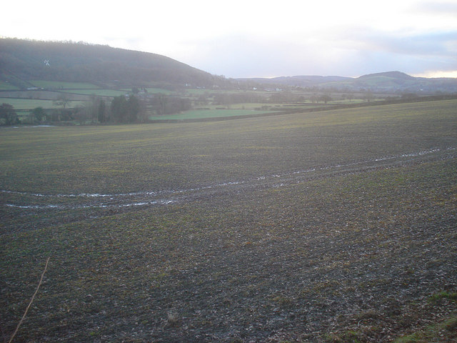
Arable land near Elton
Looking south-west from the low ridge which separates the Elton valley from Burrington. Gatley Long Coppice on the hill opposite. Halfway up that hill on the left is the white mock windmill near Leinthall Starkes.
 Map © Crown Copyright")
TIP: Click the map for more Large scale mapping
- Grid Square
- SO4471, 23 images (more nearby 🔍)
- Photographer
- Trevor Rickard (more nearby)
- Date Taken
- Wednesday, 10 December, 2008 (more nearby)
- Submitted
- Thursday, 28 May, 2009
- Subject Location
-
OSGB36:
 SO 446 710 [100m precision]
WGS84: 52:20.1054N 2:48.8158W - Camera Location
-
OSGB36: SO 447 711
- View Direction
- Southwest (about 225 degrees)