TQ2908 : Green Ridge Dew Pond
taken 14 years ago, near to Patcham, Brighton And Hove, England
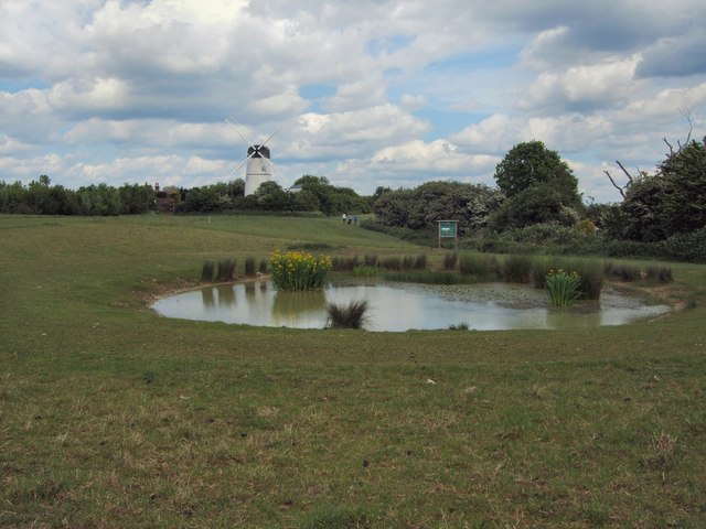
A Dew pond is an artificial pond usually sited on the top of a hill, intended for watering livestock. Dew ponds are used in areas where a natural supply of surface water may not be readily available.
They are usually shallow, saucer-shaped and lined with puddled clay, chalk or marl on an insulating straw layer over a bottom layer of chalk or lime.
Despite the name, their primary source of water is believed to be rainfall rather than dew or mist.
Link
Green Ridge is a well loved public open space, and Site of Nature Conservation Importance (SNCI), to the north of the Brighton and Hove. It is mainly open grassland dominated by Patcham windmill, with a large area of woodland called Coney Wood, an ancient hedge and a dew pond.
Some of the site has a wild and natural feel and forms a typical high downland ridge, sweeping down through Westdean towards the sea. There are spectacular views to be enjoyed all around. The site is rich in wildlife and offers a countryside experience including many opportunities for quiet recreation.
Green Ridge covers about 9 hectares (22 acres) most of which is public open space surrounded by housing to the south and the busy Mill Road and A27 to the north.
Link
 Map © Crown Copyright")
- Grid Square
- TQ2908, 80 images (more nearby 🔍)
- Photographer
- Paul Gillett (more nearby)
- Date Taken
- Sunday, 30 May, 2010 (more nearby)
- Submitted
- Sunday, 30 May, 2010
- Subject Location
-
OSGB36:
 TQ 29037 08518 [1m precision]
WGS84: 50:51.7069N 0:10.0723W - Camera Location
-
OSGB36: TQ 29025 08509
- View Direction
- Northeast (about 45 degrees)