2006
TG3915 : St Benet's Level Drainage Mill
taken 18 years ago, near to Thurne, Norfolk, England
This is 1 of 2 images, with title St Benet's Level Drainage Mill in this square
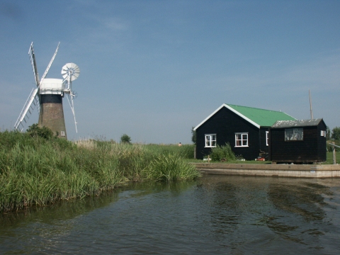
St Benet's Level Drainage Mill
A counterpoint to the famous white mill across the river at Thurne Mouth, TG4015. To the right is one of several riverside chalets in this area.
 Map © Crown Copyright")
TIP: Click the map for more Large scale mapping
- Grid Square
- TG3915, 33 images (more nearby 🔍)
- Photographer
- Katy Walters (more nearby)
- Date Taken
- Saturday, 1 July, 2006 (more nearby)
- Submitted
- Saturday, 1 July, 2006
- Subject Location
-
OSGB36:
 TG 399 156 [100m precision]
WGS84: 52:41.0956N 1:32.8792E - Camera Location
-
OSGB36: TG 399 156
- View Direction
- West-northwest (about 292 degrees)