TL9369 : Pakenham Towermill
taken 14 years ago, near to Ixworth, Suffolk, England
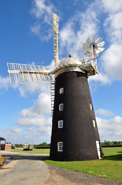
Pakenham Mill was probably built in the 1820s although dates suggest 1831-35. The mill came into the ownership of the Bryant family in 1885 (and is still in their ownership). In 1947 the mill was nearly tail-winded. The mill was restored in 1950, with a new weatherbeam.
Further restoration took place in 1961, aided by grants from West Suffolk County Council and the Ministry of Works. The work was conditional on the Bryant family's continuing to work the mill. The copper-covered cap was rebuilt and clad in aluminium for maintenance reasons. The mill was struck by lightning in June 1971, a stock being split and a sail damaged. The sack chain saved the mill from being burnt down by giving a route for the lightning to earth. When the mill was repaired a lightning conductor was added.
The most recent restoration of Pakenham windmill was completed in May 2000. The £60,000 cost of the work was 80% funded by the Heritage Lottery Fund.
Pakenham is unusual in having both a working water mill and a windmill, although the windmill (unlike the water mill) is no longer actively producing flour. Inside the windmill is a delight; the governors are of a rare chain type and there are two pairs of stones.
The windmill still does produce animal feed and visits can be arranged.
 Map © Crown Copyright")
- Grid Square
- TL9369, 261 images (more nearby 🔍)
- Photographer
- Ashley Dace (more nearby)
- Date Taken
- Thursday, 5 August, 2010 (more nearby)
- Submitted
- Thursday, 5 August, 2010
- Subject Location
-
OSGB36:
 TL 931 694 [100m precision]
WGS84: 52:17.3439N 0:49.7911E - Camera Location
-
OSGB36: TL 931 693
- View Direction
- NORTH (about 0 degrees)