TG3802 : Hardley Windpump
taken 14 years ago, near to Hardley Street, Norfolk, England
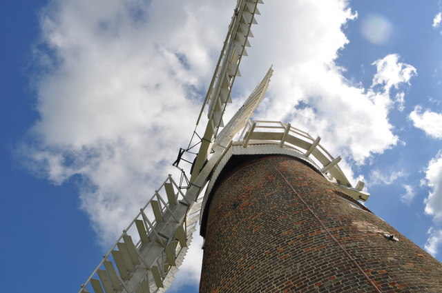
See TG3802 : Hardley Windpump - Fantail Mechanism.
The bar turns the wheel, lifting the weight on a chain. When the wind has gone gravity pulls the weight down again bringing the shutters to their original position.
Hardley windmill is a drainage windpump operating as a museum beside the River Yare. Once part of a pumping complex, there was another mill not too far away, along with a steam pumping station. Oddly the windmill replaced the steam engine. The windpump powered by an Appold turbine Link capable of rising 12 tons of water per minute via a 12 ft high vertical shaft of 5 ft in diameter Link. Built in 1874 for Sir Thomas Proctor Beauchamp (owner of Langley Hall) Link by the Ludham millwright Dan England. During construction a lean developed. The brickwork angle changed near the top to compensate for this. It operated until about 1950 when it was tailwinded* abandoned and replaced by an electrical drainage pump.
It is now open at weekends with a visitor centre. Link.
*When a mill is tailwinded it means that a sudden and violent change of wind direction has blown the sails off. The fantail can only take the sails in one direction.
 Map © Crown Copyright")
- Grid Square
- TG3802, 160 images (more nearby 🔍)
- Photographer
- Ashley Dace (more nearby)
- Date Taken
- Saturday, 28 August, 2010 (more nearby)
- Submitted
- Sunday, 29 August, 2010
- Subject Location
-
OSGB36:
 TG 387 024 [100m precision]
WGS84: 52:34.0404N 1:31.3168E - Camera Location
-
OSGB36: TG 387 024
- View Direction
- EAST (about 90 degrees)