2011
SP5805 : Benchmark on the windmill, Windmill Lane
taken 13 years ago, near to Wheatley, Oxfordshire, England
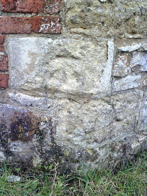
Benchmark on the windmill, Windmill Lane
Ordnance Survey cut mark benchmark described on the Bench Mark Database at Link
 Map © Crown Copyright")
TIP: Click the map for more Large scale mapping
- Grid Square
- SP5805, 49 images (more nearby 🔍)
- Photographer
- Roger Templeman (more nearby)
- Date Taken
- Thursday, 27 January, 2011 (more nearby)
- Submitted
- Friday, 28 January, 2011
- Subject Location
-
OSGB36:
 SP 5887 0523 [10m precision]
WGS84: 51:44.5613N 1:8.9260W - Camera Location
-
OSGB36: SP 5887 0523
- View Direction
- NORTH (about 0 degrees)