2005
TA1230 : The Mill, Holderness Road
taken 19 years ago, near to Sutton-on-Hull, Kingston Upon Hull, England
This is 1 of 4 images, with title The Mill, Holderness Road in this square
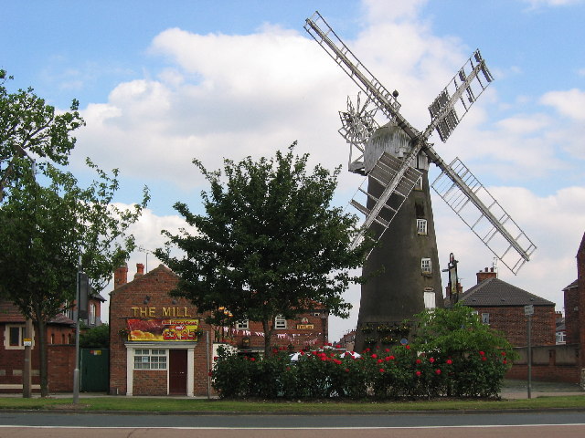
The Mill, Holderness Road
Looking south over Holderness Road from the Leisure Centre. Hoderness Road is mixed shops and housing With East Park to the north in the adjacent square.
 Map © Crown Copyright")
TIP: Click the map for more Large scale mapping
- Grid Square
- TA1230, 580 images (more nearby 🔍)
- Photographer
- Stephen Horncastle (more nearby)
- Date Taken
- Saturday, 2 July, 2005 (more nearby)
- Submitted
- Monday, 4 July, 2005
- Subject Location
-
OSGB36:
 TA 1228 3093 [10m precision]
WGS84: 53:45.7579N 0:17.8936W