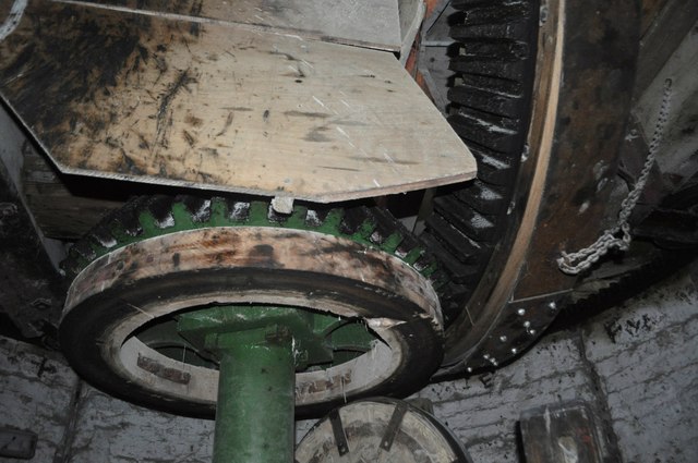
SK8214 : Whissendine Windmill - Wallower
taken 13 years ago, near to Whissendine, Rutland, England
Whissendine Windmill is a large towermill in the Rutland village of Whissendine. Originally built in 1809 by the Earls of Harborough it was constructed out of local ironstone like most of the village.
Gale damage in 1922 shut the operation down until 1995 when Nigel Moon bought it and began restoring the building for commercial use. It grids organic flour today and can be visited with permission. Inside it is packed with machinery, including four pairs of stones. Also of interest is the Wegman's Roller Mill, dating from 1878.
National Mills Weekend is an annual celebration of the UK's milling heritage. The event is organised by the Mills Section of the Society for the Protection of Ancient Buildings.
The 2011 dates were the 14th and 15th May. Over 450 buildings were open to visitors meaning many to choose from. They ranged from fully working wind and water mills to under restoration or rarely open buildings.
 Map © Crown Copyright")
- Grid Square
- SK8214, 90 images (more nearby 🔍)
- Photographer
- Ashley Dace (more nearby)
- Date Taken
- Saturday, 14 May, 2011 (more nearby)
- Submitted
- Sunday, 15 May, 2011
- Subject Location
-
OSGB36:
 SK 823 142 [100m precision]
WGS84: 52:43.1626N 0:46.9354W - Camera Location
-
OSGB36: SK 823 142
- View Direction
- West-northwest (about 292 degrees)