2012
ST5673 : Clifton Observatory Area - BS8
taken 12 years ago, near to Clifton, Bristol, England
Clifton Observatory Area - BS8
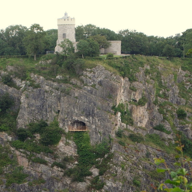
This was constructed as a corn miller's windmill in 1776 courtesy of its owners, the city's Merchant Venturers. It may subsequently have become a snuff mill until 1777 when, over-driven during a gale, the wooden pivots caught fire and the mill was burnt out. The tower remained a picturesque ruin until the Merchant Venturers grant William West, a professional artist, a 5 year lease and allowed him to turn it into an observatory. In terms of the natural cavity below it, it was not until 1837 that a 200ft tunnel was built linking the Observatory and "The Giant's Cave" in St Vincent's Rocks thereby allowing the public access to the balcony.
 Map © Crown Copyright")
TIP: Click the map for more Large scale mapping
- Grid Square
- ST5673, 932 images (more nearby 🔍)
- Photographer
- David Hallam-Jones (more nearby)
- Date Taken
- Wednesday, 1 August, 2012 (more nearby)
- Submitted
- Friday, 24 August, 2012
- Subject Location
-
OSGB36:
 ST 5652 7315 [10m precision]
WGS84: 51:27.3390N 2:37.6299W - Camera Location
-
OSGB36: ST 5627 7303
- View Direction
- East-northeast (about 67 degrees)