2014
SK0614 : Windmill conversion
taken 10 years ago, near to Upper Longdon, Staffordshire, England
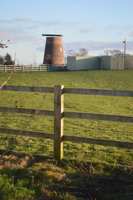
Windmill conversion
Somewhat different to SK0614 : Windmill Cottage, Upper Longdon. The unsympathetic 1970s conversion has been removed. The planning application shows a restoration with working sails to generate electricity.
 Map © Crown Copyright")
TIP: Click the map for more Large scale mapping
- Grid Square
- SK0614, 11 images (more nearby 🔍)
- Photographer
- John M (more nearby)
- Date Taken
- Saturday, 11 January, 2014 (more nearby)
- Submitted
- Saturday, 11 January, 2014
- Subject Location
-
OSGB36:
 SK 066 148 [100m precision]
WGS84: 52:43.8750N 1:54.1688W - Camera Location
-
OSGB36: SK 065 149
- View Direction
- East-southeast (about 112 degrees)