2005
TG3815 : St Benet's Abbey Drainage Mill
taken 19 years ago, near to Upper Street, Norfolk, England
This is 1 of 2 images, with title St Benet's Abbey Drainage Mill in this square
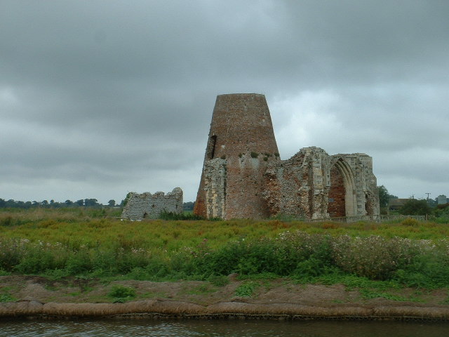
St Benet's Abbey Drainage Mill
The Mill was constructed using existing walls of the derelict Abbey, on the banks of the River Bure
 Map © Crown Copyright")
TIP: Click the map for more Large scale mapping
- Grid Square
- TG3815, 99 images (more nearby 🔍)
- Photographer
- David Medcalf (more nearby)
- Date Taken
- Sunday, 14 August, 2005 (more nearby)
- Submitted
- Monday, 29 August, 2005
- Subject Location
-
OSGB36:
 TG 380 157 [100m precision]
WGS84: 52:41.2255N 1:31.2379E - Camera Location
-
OSGB36: TG 380 156
- View Direction
- North-northeast (about 22 degrees)