2007
TL4459 : French's Mill
taken 17 years ago, near to Chesterton, Cambridgeshire, England
This is 1 of 3 images, with title starting with French's in this square
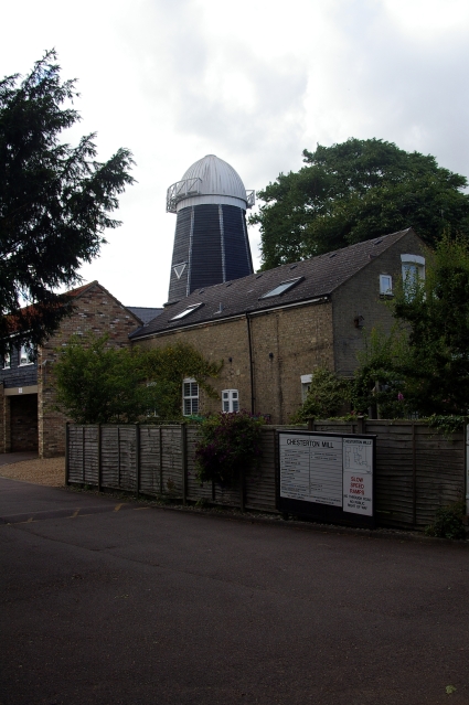
French's Mill
Also known as Chesterton Mill, this smock mill, now devoid of its sails, is hidden away at the end of French's Road. It is the last surviving windmill in the city, though there are three just beyond the boundary at:
Fulbourn TL5155
Impington TL4462
Madingley TL4059).
The maltster William Beart built the mill in 1847, but sadly died shortly afterwards. William French then acquired a lease on the property and in 1850 was able to buy the freehold (including a granary, stables, a cottage for the miller and half an acre of ground) at public auction for £440. The mill was successively converted to steam, gas and finally diesel power but continued to grind corn until 1956, and the buildings were converted into offices during the early 1980s.
For a closer view of the tower with its brick base see TL4459 : Chesterton Mill. French's Mill is listed Grade II Link
Chesterton Mill website Link
Smock Mills
There are three main types of windmill in Great Britain: post mills, smock mills and tower mills.
The smock mill is of a timber-framed construction with weatherboarded, steeply sloping external walls. It was built on a brick base. A pivoting wooden top with sails moved independently of the main structure so that the sails could be positioned towards the wind. This was controlled by a tail fan.
Windmill article Link
 Map © Crown Copyright")
TIP: Click the map for more Large scale mapping
- Grid Square
- TL4459, 1456 images (more nearby 🔍)
- Photographer
- Tiger (more nearby)
- Date Taken
- Friday, 6 July, 2007 (more nearby)
- Submitted
- Friday, 13 July, 2007
- Subject Location
-
OSGB36:
 TL 4455 5995 [10m precision]
WGS84: 52:13.1281N 0:6.8737E - Camera Location
-
OSGB36: TL 4456 5994
- View Direction
- Northwest (about 315 degrees)