2007
TQ6220 : Blackdown Mill
taken 17 years ago, near to Punnett's Town, East Sussex, England
This is 1 of 12 images, with title Blackdown Mill in this square
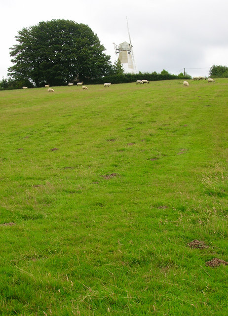
Blackdown Mill
The original mill burnt down in 1859 and was replaced by another moved wholesale from Biddenden in Kent. Consequently, this mill is sometimes known by its original name, Cherry Clack Mill. The sweeps fell into disrepair and were removed sometime in the 1930s though the mill continued to grind using a combustion engine instead, it was after the war that the original family decided on restoration. Taken from the footpath that heads up the slope from Greenwoods Lane towards the mill.
 Map © Crown Copyright")
TIP: Click the map for more Large scale mapping
- Grid Square
- TQ6220, 73 images (more nearby 🔍)
- Photographer
- Simon Carey (more nearby)
- Date Taken
- Wednesday, 25 July, 2007 (more nearby)
- Submitted
- Thursday, 26 July, 2007
- Subject Location
-
OSGB36:
 TQ 627 208 [100m precision]
WGS84: 50:57.8348N 0:18.9592E - Camera Location
-
OSGB36: TQ 626 208
- View Direction
- East-southeast (about 112 degrees)