2007
TL5858 : Six Mile Bottom Windmill
taken 17 years ago, near to Six Mile Bottom, Cambridgeshire, England
This is 1 of 5 images, with title Six Mile Bottom Windmill in this square
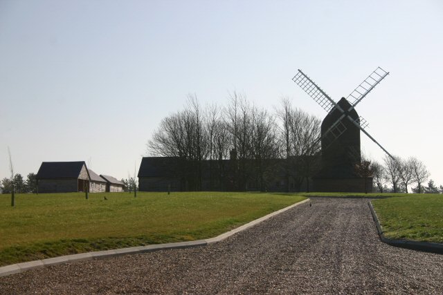
Six Mile Bottom Windmill
The entrance drive to the private house that forms part of this mill conversion. See TL5858 : Six Mile Bottom Windmill.
 Map © Crown Copyright")
TIP: Click the map for more Large scale mapping
- Grid Square
- TL5858, 31 images (more nearby 🔍)
- Photographer
- Bob Jones (more nearby)
- Date Taken
- Thursday, 8 March, 2007 (more nearby)
- Submitted
- Thursday, 8 March, 2007
- Subject Location
-
OSGB36:
 TL 588 582 [100m precision]
WGS84: 52:11.9598N 0:19.3653E - Camera Location
-
OSGB36: TL 587 582
- View Direction
- East-southeast (about 112 degrees)